You are here
Inter-state Border Disputes in Northeast India

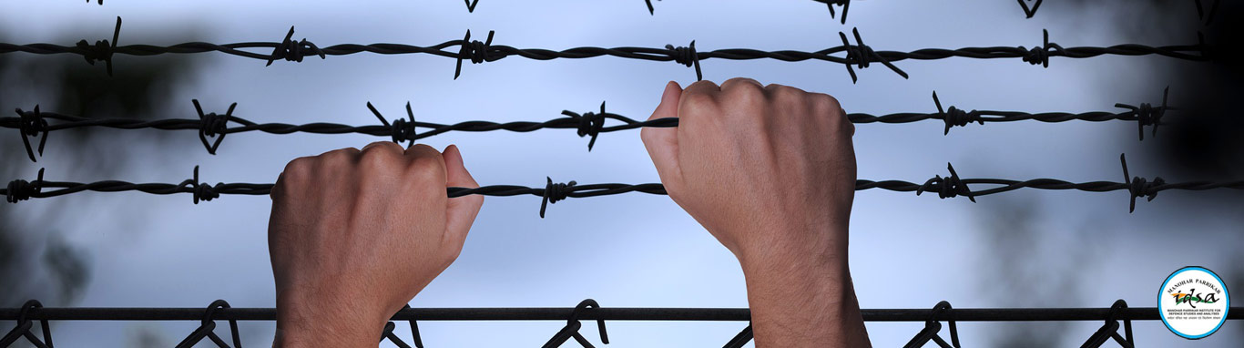
 Summary: Border disputes between various states in Northeast India have been recurring since the 1960s. These disputes emerged after states such as Nagaland, Meghalaya, Arunachal Pradesh and Mizoram were carved out of undivided Assam. However, almost all these border disputes have their origins in colonial times and reflect the consequences of the British policy of creating and recreating boundaries for administrative convenience based on annexation and exploration of territories in the region. The Union government has made efforts to resolve these disputes, however not much success has been achieved as one or the other state remained non-cooperative. Non-resolution of these disputes has given rise to strong community sentiments among states concerned and resultantly vitiated the inter-state relations. Further, the security situation of the region is jeopardised with insurgents and criminals gaining the upper hand. The need of the hour is to shape public opinion for peaceful borders and redouble efforts for a political solution to these decades-old disputes.
Introduction
Northeast India has been witnessing inter-state border disputes since the early 1960s when the process of carving out states from the undivided Assam commenced. The most recent in the series of border disputes that plagued the region is the Assam–Mizoram border, which has been witnessing violent incidents since 2020.1 The situation took a worse turn on 26 July 2021, when six policemen from Assam were killed in a violent clash. It was alleged that the Assam Police were fired upon by the Mizoram Police.2 The situation, in fact, is a culmination of a series of allegations and counter-allegations of encroachment by Assam and Mizoram since June 2021. On 30 June 2021, the Mizoram government accused the Assam government officials of encroaching into an area called Aitlang hnar in Mizoram and destroying plantation crops. On their part, the Assam government claimed that Mizo residents have encroached upon 6.5 km inside the Assamese territory and planted banana and betel nut saplings besides constructing makeshift settlements.3
Reiterating its claim that Mizoram had encroached upon Assam’s land, the Chief Minister of Assam, Himanta Biswa Sarma, stated in the state assembly that the Mizoram–Assam border has recorded 200 incidents of violence and 40 cases of encroachment since 2016. He also stated that all three districts sharing a border with Mizoram have been encroached upon with Cachar District witnessing 25 cases of encroachment followed by Hailakandi with 16 cases. Assam claims that, in all, 1,777.58 hectares of land has been encroached upon by Mizoram.4 These charges were refuted by the Mizoram government which claims to have satellite imageries to prove that the Mizos have been settled in these areas for 100 years.5
Assam–Mizoram Border Dispute
Mizoram was carved out of Assam and established as a Union Territory in 1972 and as a full-fledged state in 1987. The two states share a 164.6 km-long border. The boundary between the two states is defined in the North-Eastern Areas (Reorganisation) Act of 1971, which in turn is based on Notification No. 2106 AP dated 9 March 1933. During the 1950s, the Assam government tried to demarcate the boundary between Assam and the Lushai Hills District, but its effort was halted when the office of the Assam survey department was set on fire by miscreants from Mizoram. The first major instance of a border dispute between the two states came to the fore in 1994, when Mizoram objected to Assam’s attempt to extend its control over the Reserve Forests. Major clashes along the border broke out in 2006, 2018, 2020, and more recently in 2021.
The dispute between Assam and Mizoram stems from the latter’s refusal to accept the present boundary with Assam as notified in 1933 arguing that it was a decision imposed upon them by the British. Mizoram suggests that the Inner Line Reserved Forest, as described in the 1875 notification under the Bengal Eastern Frontier Regulation Act of 1873, should be the basis for delineating the border.6 In all, Mizoram claims 819.15 sq. km of forested territory from Assam. Assam government’s contention is that the 1875 notification mentioned the Inner Line, which was only a line limiting the administrative extent of the Assam government and was never meant as a boundary line between Cachar and Lushai Hills.
Present Situation
At present, the situation remains tense along the border. Central forces are deployed along the border—Sashastra Seema Bal (SSB) and Central Reserve Police Force (CRPF) on Assam side and the Border Security Force (BSF) on Mizoram side of the border—to act as a buffer between the state police forces. Efforts are being made to diffuse the tension. On 9 July 2021, the Union home secretary convened a meeting of the chief secretaries of both the states to arrive at some sort of agreement, but it remained inconclusive as Mizoram sought more time to hold consultations on Assam’s proposal for maintaining the status quo as in 2020.7
It is important to note that most of the meetings between the officials intended to defuse tensions following border clashes rather than finding a permanent solution. In this respect, it is important to note that in wake of a similar violent incident in 2018, the Mizo youth and civil society organisations had requested the Union government to constitute a boundary commission to demarcate the boundary,8 but no decision was taken by the Union government in this regard.
Apart from Mizoram, other states in the Northeast are also embroiled in border disputes with Assam. The longest and the bloodiest of these is the border dispute between Assam and Nagaland.
Assam–Nagaland Border Dispute
Assam and Nagaland share a 434 km-long border. While the border dispute between the two states began right after Nagaland attained statehood in 1963, it is important to note that even before India gained independence, the Naga National Council (NNC) had demanded the return of the territories which formed part of Naga Hills District. This demand was included in the Nine Point Agreement signed between Governor of Assam Sir Akbar Hydari and the NNC in June 1947. Point No. 6 of the Agreement mentions bringing back all the forests transferred to Sibsagar and Nowgong (Nagaon) districts as well as all the Naga-inhabited contiguous areas to Naga Hills District.9 The restoration of the “Naga areas” was raised again and placed on record under Point Nos 12 and 13 in the 16-Point Agreement signed between the Union government and the Naga People’s Convention (NPC) in 1960.10 As is evident, the Government of India did not take any action on this demand but decided to confer statehood to the Nagas to achieve their political aspirations.
Accordingly, the State of Nagaland Act, 1962 was enacted which defined its borders based on the 1925 notification.11 The government of the newly formed state of Nagaland, however, did not accept the boundary delineation and demanded that Nagaland should comprise the erstwhile Naga Hills and all Naga-dominated areas in North Cachar and Nowgong (Nagaon) districts, which were part of the Naga territory in 1866. In all, Nagaland demands 12,488 sq. km of Assamese territory, all of which comprise 10 Reserve Forests.
The refusal of Nagas to accept the notified boundary saw large forested tracts of Assam encroached upon by the Naga rebels in the 1960s, which were used as hideouts. These insurgent groups were followed by the common Naga people who started settling in these forested areas with the encouragement of the Nagaland government and were protected by the Naga rebels. As encroachments increased, tensions between Assam and Nagaland flared up resulting in the first border clashes in 1965. Since then, violent clashes along the Assam–Nagaland border have become a regular feature, with major armed conflicts reported in 1968, 1979, 1985 and the latest in 2014.
Efforts at Dispute Resolution
In 1967–68, an attempt was made to resolve the border dispute when both state governments agreed to allow the Survey of India to demarcate the Assam–Nagaland boundary. Unfortunately, the survey had to be abandoned as the Nagaland government did not cooperate. The first substantive attempt at resolution of the border dispute was taken by the Union government after the 1968 clashes when it constituted the Sundaram Committee in 1971, with the mandate to determine the boundary between Assam and Nagaland. In 1972, on the suggestion of Justice K.V.K. Sundaram, Assam and Nagaland signed four agreements to maintain the status quo till the submission of the report. However, despite signing these interim agreements, Nagaland continued to encroach upon the reserve forest land in Assam which resulted in frequent frictions along the border and a major violent incident in 1979.12
Following the 1979 incident, a number of steps were taken to resolve the issue. First, a 10 km wide Disputed Area Belt (DAB), a neutral area inside Assam administrative boundary claimed by Nagaland, was created and divided into three sectors—A (Diphu RF), B (South Nambor RF), and C (Rengma RF).13 It lies in Assam’s Golaghat and Jorhat districts and Nagaland’s Wokha and Mokokchung districts. Second, the CRPF and the Assam Rifles (in lesser numbers) were deployed in the DAB as a neutral force to maintain peace. Third, the Union government tried to persuade both state governments to resolve the issue through dialogue and an agreement was signed to implement the agreements signed in 1972. Fourth, the Sundaram Committee Report, which was submitted to the centre informally in 1974, was made available to both governments in 1979. The report stated that boundary demarcation should be done according to the 1925 notification, thereby rejecting the claims of Nagaland except in regard to the 300 sq. km Dessoi Valley reserve forest. The report also suggested a joint survey of the border areas. The Nagaland government refused to accept its recommendations terming it “one sided”.
Another attempt at resolving the issue was made in 1985 when the Shastri Commission was constituted following the Merapani incident. Merapani incident also led to the creation of sector D (Doyang RF) in the DAB. The Shastri Commission indicted the Nagaland government for precipitating violence and recommended that four interim agreements should be implemented robustly and provided that the Assam government had full administrative rights over its constitutional boundary. It also recommended the constitution of a boundary commission to demarcate the border.14 The report was rejected by Nagaland.
Frustrated by the setting up of polling stations inside the Assamese territory by the Nagaland government, the Assam government filed a civil suit in the Supreme Court under Article 131 of the Constitution of India for identification of boundaries between Assam and Nagaland in 1988.15 In 1995, the Assam government withdrew the suit only to renew it in 1998. Meanwhile, in 1997, the Union government constituted a commission under J.K. Pillai to resolve the issue. However, the Assam government rejected the commission’s report.16
In September 2004, the Supreme Court, while hearing the petition of the Assam government, ordered the constitution of a local commission to ascertain the boundary. But the Nagaland government did not cooperate.17 It was only in September 2006, after Nagaland was compelled to comply with the Supreme Court orders, that the Local Commission under Justice S.N. Variava was constituted. However, as Variava expressed his inability to continue, Justice Tarun Chatterjee was appointed in his stead. The Local Commission was mandated to identify the boundaries of Assam by taking into account legal, historical and other aspects. It was stated that pleas could be filed against its recommendations as it was not a boundary commission.18 The commission submitted its report to the Ministry of Home Affairs, but it is reported that the Nagaland government has reservations against this commission.
The Supreme Court also attempted to resolve the dispute amicably through mediation. Stating that “adjudication cannot resolve such differences that have become a routine affair”19, the Supreme Court appointed senior advocates Sriram Panchoo and Niranjan Bhat to mediate between Assam and Nagaland in August 2010. The mediators held meetings with representatives of the two state governments; the mediation proceedings were to be independent of the proceedings of the Local Commission. The mediators submitted their report, but it was not accepted by both Assam and Nagaland governments.
Present Situation
Given the failure of the mediation process, the Supreme Court, in January 2015, ordered both the governments to file the list of their witnesses along with their testimonies in the form of affidavits with the apex court registrar.20 The recording of the testimonies of Assam witnesses is nearly complete but the progress is stalled because of the ongoing pandemic. It is important to note that the Nagaland government had stated in the past that the best way to resolve the boundary dispute is through negotiations, but the Assam government is not amenable to this proposal. Meanwhile, the Reserve Forests which are a part of the disputed belt are being encroached upon by citizens of both Assam and Nagaland with full support from their respective governments. The Assam government alleges that Nagaland had claimed encroached upon 589 sq. km of Assam land.
As settlements grew, people from both states came in close contact resulting in frequent clashes. Since the DAB is a neutral zone, it is beyond the reach of the administration of the two states. In case any dispute arises, it is resolved through gaon buras or village heads by directly negotiating with the persons concerned. On the ground, the border dispute is highly politicised with student unions, insurgent groups as well as vested political interests from both sides inflaming sentiments and rigidly holding to their positions. One of the reasons for the consolidation of claims by both sides could be the prospect of generating revenue through exploration of oil and gas as well as through the tea gardens as the DAB is rich in natural resources.21 It is important to note that the resolution of the Assam–Nagaland border dispute also hinges upon the outcome of the Naga peace process.
Assam–Arunachal Border Dispute
Arunachal shares an 804.1 km long boundary with Assam. The boundary dispute between the two states came to the fore after the establishment of Arunachal Pradesh as a Union Territory in 1972. The process of demarcation of the boundary between Assam and Arunachal started in 1972 and by 1979, 396 km of the boundary was demarcated.22 However, a number of anomalies and disputes regarding the border surfaced during the survey. As a result, the process of demarcation had to be suspended.
The border dispute between the two states arose when Arunachal Pradesh refused to accept the 1951 notification as the basis of boundary delineation. In April 1951, on the recommendations of the Bordoloi Committee, a total of 3,648 sq. km of the plain area comprising the present-day Darrang, Dhemaji and Jonoi districts was transferred to Assam.23 Arunachal argues that the plain area was transferred to Assam without the consent of its people. It claims that the people of Arunachal Pradesh have traditional and customary rights over these lands which were also recognised by the British as well as the Ahom rulers through the payment of posa. The Assam government, however, argues that the boundary is constitutional and cannot be altered.
Efforts at Dispute Resolution
Several efforts have been made to arrive at some kind of resolution to the border dispute. In 1979, both governments agreed to set up a high-powered committee to discuss the disagreements, but nothing came of it. In 1983, the Arunachal government sent a proposal to Assam asking it to return 956 sq. km of land, but the Assam government did not respond. In 1989, Arunachal again renewed its claim and argued that it has been magnanimous and asking only a small portion of the plain land transferred to Assam. In response, the Assam government filed a civil suit in the Supreme Court requesting it to ascertain the Assam–Arunachal boundary.24 Incidentally, in 2007, Arunachal presented its proposal in front of the Tarun Chatterjee Commission in which it increased its request of return of territory from 956 sq. km to 1,119.2 sq. km.25 Assam rejected it in 2009 and argued that the boundary should be settled in the spirit of give and take. It is reported that the Commission upheld 70–80 per cent of Arunachal Pradesh’s claim.26
Present Situation
Assam has raised the issue of encroachment in 2020 and claimed that Arunachal Pradesh has encroached upon 6,375 hectares of its forest land.27 It is important to note that the Assam government has been periodically launching eviction drives in the encroached lands leading to violence on the ground and tensions such as in 2005 and 2014. The present situation on the border is calm but could flare up at any moment given that encroachment from both sides is taking place at a rapid pace. In particular, the Bodos from Assam and the Nyshis from Arunachal Pradesh are at the forefront of this encroachment. The issue is also politicised by various vested interest groups.
Assam–Meghalaya Border
Meghalaya was carved out of Assam as an autonomous state in 1970 and became a full-fledged state in 1972. Assam shares an 884.9 km long border with Meghalaya. The border dispute stems from the Meghalaya government’s refusal to accept the Assam Reorganisation (Meghalaya) Act of 1969. There are at present 12 points of dispute along the Meghalaya–Assam border covering an area of 2,765.14 sq. km.28
Like in the case of Arunachal Pradesh, in April 1951, on the recommendations of the Bordoloi Committee, Blocks I and II of Jaintia Hills were transferred to the Mikir Hill (Karbi Anglong) District of Assam and areas in Garo Hills to Goalpara District of Assam. The contiguous areas in Ri Bhoi District were also transferred to the Kamrup District of Assam. The 1969 Reorganisation Act reiterates these transfers and accordingly defines the boundary of Meghalaya.29
Meghalaya claims that these areas originally belong to the Khasi–Jaintia Hills and that the inhabitants belong to the Khasi Pnar tribe, therefore, these areas should belong to Meghalaya. It also claims that some of these territories were also lost to the British by the Khasi chieftains. The Assam government on the other hand asserts that Meghalaya Archives does not have the documents to prove that these areas historically belonged to Meghalaya. And that it will adhere to the maps which were created in 1979–80.
Efforts at Dispute Resolution
Initial attempts at resolving the border dispute were mainly through negotiations between the two governments. In May 1983, both the governments constituted a joint official committee to resolve the issue. The committee submitted its report in November 1983 in which it suggested that the dispute should be settled by re-delineation of the border by the Survey of India with the cooperation of both the states. However, no action was taken to implement the recommendations. Meanwhile, more areas along the border began to be disputed. To resolve the disputes, Assam and Meghalaya agreed to constitute an independent committee. Accordingly, a committee headed by Justice Y.V. Chandrachud was constituted in 1985. The committee submitted its report in 1987 and reportedly upheld the claims of Assam. The Meghalaya government however rejected the committee’s report.30
As the border disputes increased and became more violent, both the governments agreed in January 1991 to jointly demarcate the border with the help of Survey of India. By the end of 1991, around 100 km of the border was demarcated but later Meghalaya government refused to cooperate arguing that the manner in which the border was demarcated was unconstitutional.
About 20 years later in 2011, the Meghalaya assembly passed a resolution asking the Union government to intervene and constitute a boundary commission. In response, the Assam assembly passed a resolution opposing the move of the Meghalaya government. However, at the behest of the Union government, both the governments appointed nodal officers to discuss the border dispute. They meet periodically to minimise the points of difference and maintain the status quo along the border. In 2019, the Meghalaya government filed a petition in the Supreme Court urging it to direct the Union government to settle the border dispute. The Supreme Court dismissed the petition and ordered the Meghalaya government to approach the Centre directly.31
Present Situation
The border disputes persist with occasional flaring up of violent incidents as both civilians and governments attempt to encroach upon areas and build structures for residential or official purposes. Till date, the situation has been under control through an effective dialogue between the governments at various levels.
Conclusion
The inter-state border disputes in the Northeast have persisted for long. Several attempts at resolving these disputes have been unsuccessful indicating the collective failure of Union and state governments. After every major incident, the Union government or the Supreme Court have appointed commissions, which recommended ways to resolve the issue. However, since these recommendations were not binding upon the states, one or the other state government rejected the reports if its claim was not favoured. The appointment of commissions itself can be seen as a delaying tactic by the governments rather than searching for solutions. Meanwhile, the persistence of border disputes has vitiated inter-state relations and jeopardised the security situation in the region as insurgent groups and criminals have gained an upper hand to foment further tensions. In fact, the border disputes have become highly politicised with political leaders and student organisations mobilising public sentiments in their favour.
While Assam, Nagaland and Arunachal Pradesh await the verdict of the Supreme Court, state governments have stated that they want a peaceful resolution of the border areas based on negotiations. But a negotiated settlement to these border disputes appears to be a non-starter. For example, while Nagaland opts for an out-of-court settlement, Assam favours a court ruling. The state leaders, however, are not confident of accepting the verdict of either process without people’s involvement. In such a scenario, it is incumbent on the political leaders in the region to cool raging tempers and spread awareness about the benefits of settled and peaceful borders in terms of better infrastructure, connectivity and the realisation of the full potential of India's Act East Policy.32 At the same time, efforts should be redoubled to find a political solution, mediated by the Union government, which is binding on all the states concerned in the Northeast.
Views expressed are of the author and do not necessarily reflect the views of the Manohar Parrikar IDSA or of the Government of India.
- 1. The months of October and November 2020 saw intense violent clashes, allegations of encroachment, an economic blockade as well as the bombing of a closed school. Manoj Anand, “Assam-Mizoram Border Blockade Back Just a Week after Resolution”, Deccan Chronicle, 30 October 2020.
- 2. “Five Assam Policemen Killed in Violent Turn to Border Dispute with Mizoram”, The Indian Express, 27 July 2021. Even as the Assam-Mizoram border witnessed violence, a skirmish erupted along the Assam-Meghalaya border, which was brought quickly under control. For details, see “Situation in Meghalaya-Assam Border under Control: Conrad Sangma”, India Today, 28 July 2021.
- 3. “Mizoram, Assam Spar over Encroachment as Border Dispute Escalates”, The Indian Express, 19 July 2021.
- 4. “People of Mizoram have Encroached Upon 1,777 Hectares of Assam Land: CM Himanta Biswa Sarma”, India Today, 13 July 2021.
- 5. Ratnadip Choudhury, “Border: Mizoram on Himanta Biswa Sarma’s Assam Territory Claim”, NDTV, 17 July 2021.
- 6. J. Zahluna, “Inner Line Regulation and Mizoram”, The Indian Journal of Political Science, Vol. 72, No. 1, January–March 2011, pp. 221–225; and Karishma Hasnat, “All about Assam-Mizoram Border Dispute, Which Dates Back 50 yrs & Still Remains Unresolved”, The Print, 21 October 2020.
- 7. “Assam-Mizoram Border Dispute Talks Remain Inconclusive”, Outlook, 9 July 2021.
- 8. Alinery Lalngilneii Lianhlawng, “Mizoram-Assam Border Dispute”, Land Conflict Watch, 3 December 2019.
- 9. “Naga-Akbar Hydari Accord (Nine Point Agreement)”,Kohima, 26–28 June 1947.
- 10. “The 16 Point Agreement between the Government of India and the Naga People’s Convention”, 26 July 1960.
- 11. “The State of Nagaland Act, 1962”, Act No. 27 of 1962, 4 September 1962.
- 12. R.K. Shastri, “Report of the Commission of Inquiry on the Incidents Relating to the Assam-Nagaland Border Conflict April-June 1985”, Ministry of Home Affairs, 1985, pp. 28–29.
- 13. C.K. Kindo and D. Minj, “Impact of Assam-Nagaland Territorial Dispute in the District of Golaghat, Assam”, in Lazar Jeyaseelan (ed.), Conflict Mapping and Peace Processes in North East India, North Eastern Social Research Centre, Guwahati, 2008, pp. 15–16.
- 14. Ibid, p. 152.
- 15. “Assam-Nagaland Boundary Dispute”, Government of Assam.
- 16. C.K. Kindo and D. Minj, no. 13, p. 20.
- 17. “SC for a Court Commission to Determine Boundaries of Assam”, Outlook, 13 September 2004.
- 18. “Disputed Land Should be Returned to Arunachal, Says Panel Report”, The Indian Express, 1 February 2014.
- 19. Bhadra Sinha, “In a First, SC Refers Border Row to Mediators”, Hindustan Times, 21 August 2010.
- 20. “Court Decision or Arbitration can Resolve Assam-Nagaland Border Row: SC”, Zee News, 14 January 2015.
- 21. “ONGC Starts Drilling Oil along Assam-Nagaland Border Area”, Business Standard, 24 January 2013.
- 22. Dakter Esse, “A Study of Assam–Arunachal Pradesh Border Narratives”, Ph.D. Thesis, Department of Cultural Studies, Tezpur University, 2017, p. 73.
- 23. Notification No. RSS. 135/51/5 dated 25.4.1951, as cited in Bhubaneshwar Bhattacharyya, The Troubled Border, Lawyer’s Book Stall, Guwahati, 1995.
- 24. “Border Dispute with Arunachal Pradesh”, Government of Assam.
- 25. Dakter Esse, no. 22, p. 94.
- 26. The Indian Express, no. 18.
- 27. “After the Row with Mizoram, Assam Raises Border Issue with Arunachal”, The Hindu, 6 November 2020.
- 28. “Dual Voter Cards in Way of Settling Border Row with Assam: Meghalaya Minister”, The Hindu, 17 January 2020.
- 29. Block I comprise 143 villages, and Block-II comprise 213 villages. “The Assam Reorganisation (Meghalaya) Act, 1969 Act No. 55 of 1969”, 29 December 1969.
- 30. For details, see Patricia Mukhim, “Who’s the Referee? Assam-Meghalaya Border Disputes”, The Shillong Times, 16 July 2021.
- 31. “SC Dismisses Petition on Meghalaya-Assam Boundary Dispute”, The Northeast Today, 22 April 2019.
- 32. Based on observations made by Ambassador Sujan R. Chinoy during the author’s presentation on the subject at MP-IDSA on 19 July 2021.